
Yosemite West Property & |
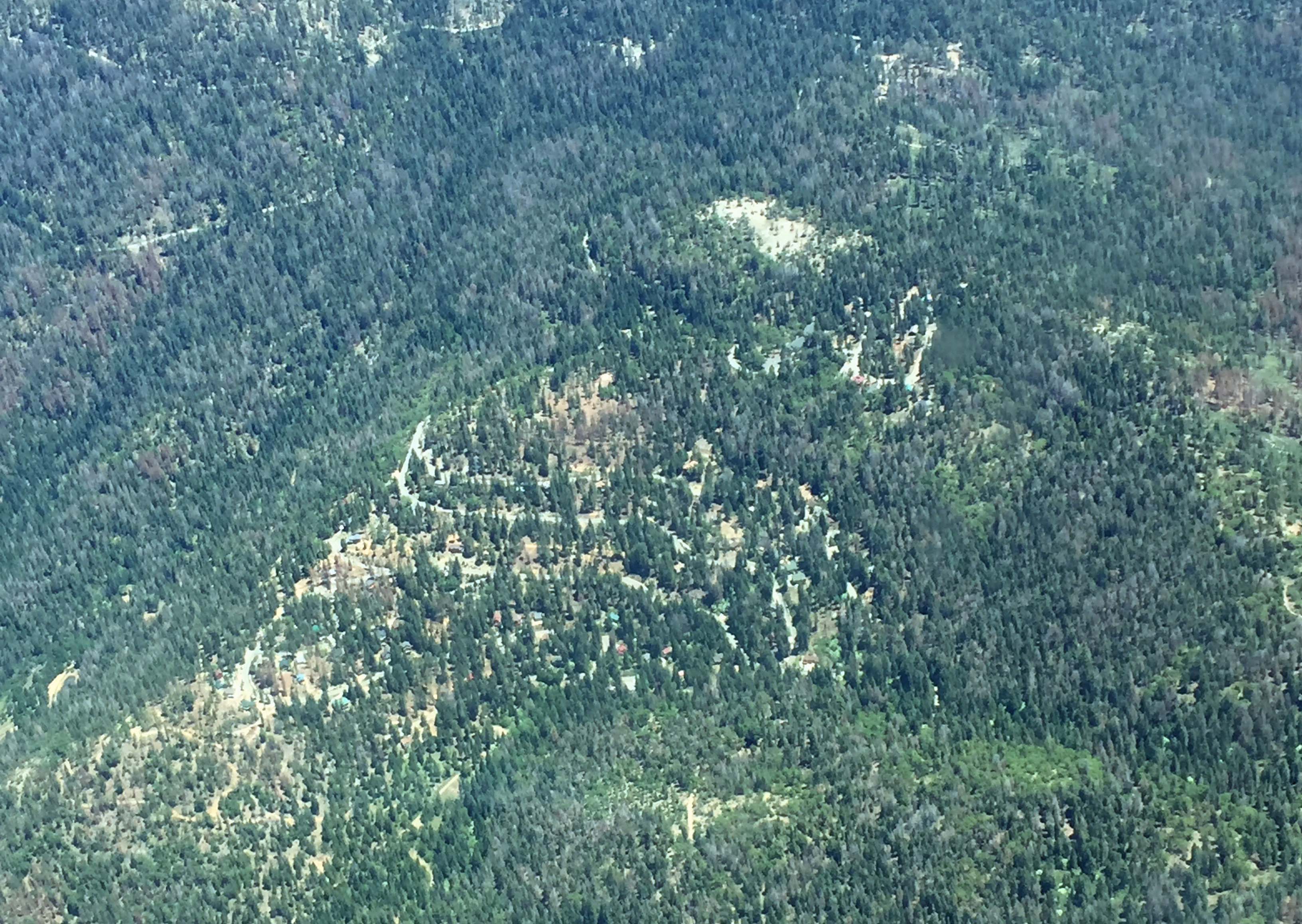
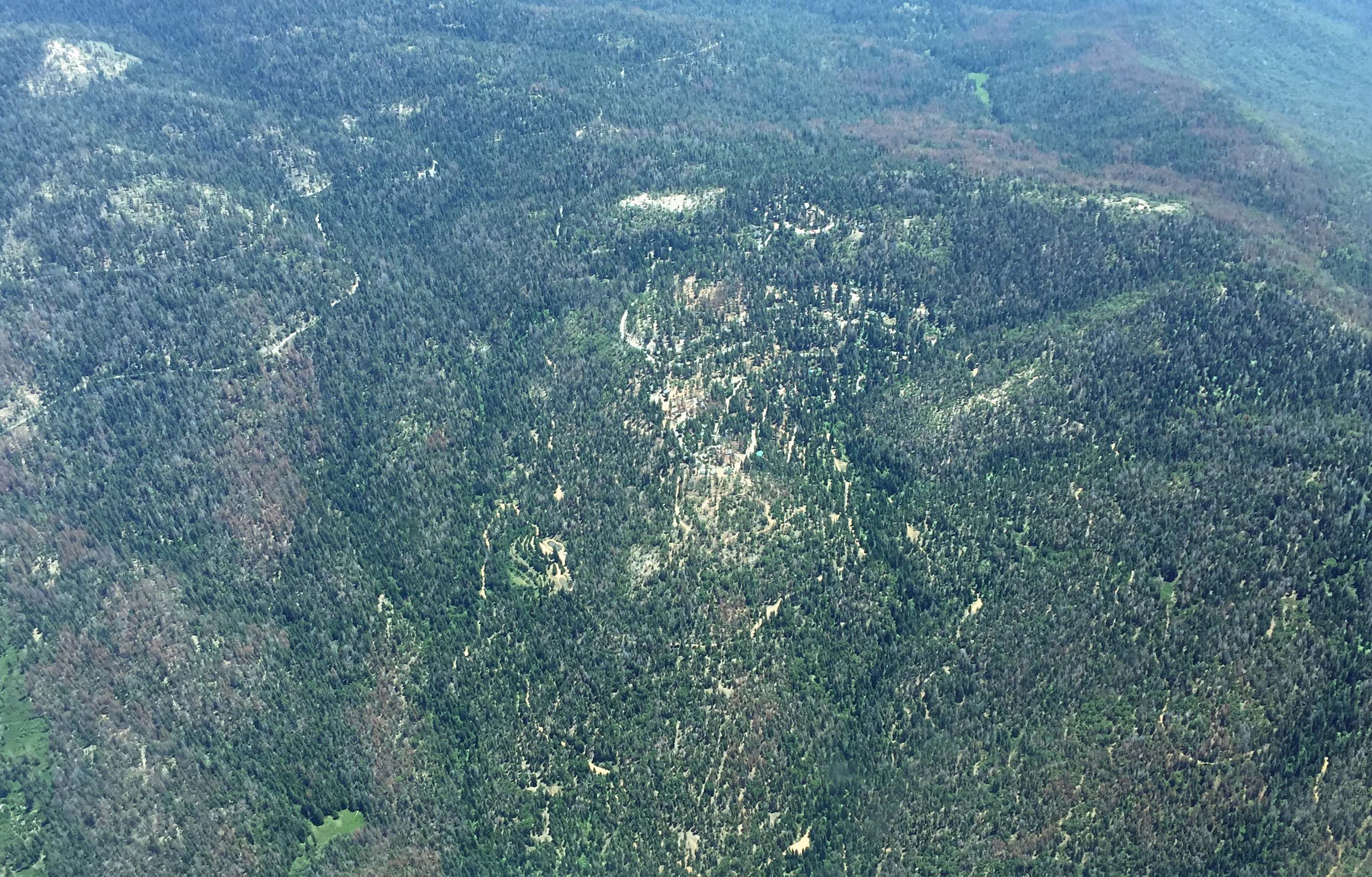
Despite the grant-funded tree mortality and fuel reduction projects ongoing in Yosemite West, tree mortality in and around Yosemite West is also ongoing. Dead trees, which appear as brown swaths in the images below, surround the community of Yosemite West on all sides of Henness Ridge. Our thanks to Yosemite West owner Betsy Ringrose (photographer) and her husband Ed Adasiak (pilot) for sharing these images.
The images depict the serious and ongoing threat that tree mortality poses to Yosemite West. All property owners need to keep working to maintain and increase their defensible space.
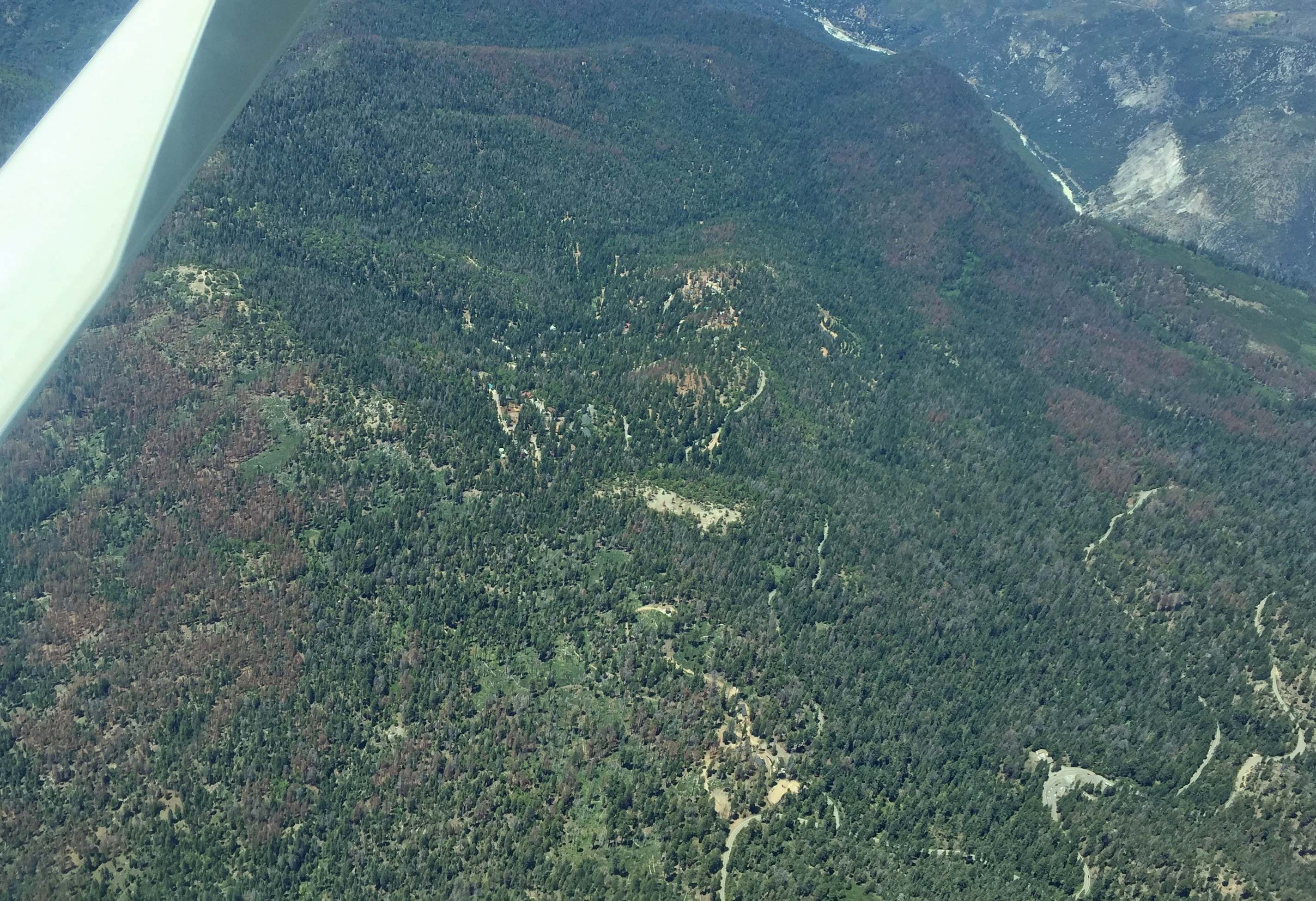
Yosemite West (center), Chinquapin (bottom center), Wawona Road (bottom right), Mereced River (top right); view west

Yosemite West (center), Chinquapin (bottom center), Wawona Road (bottom right), Mereced River (top right); view west
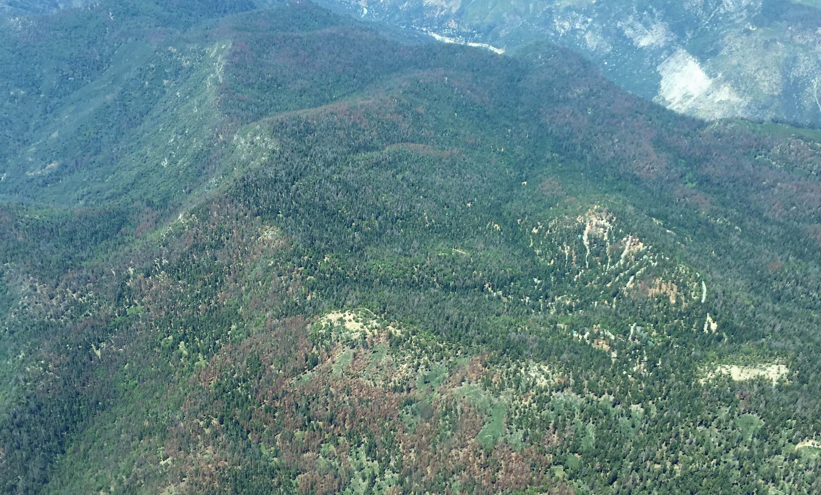
Yosemite West (center right), Henness Ridge and Fire Lookout (center), Mereced River (top right); view west
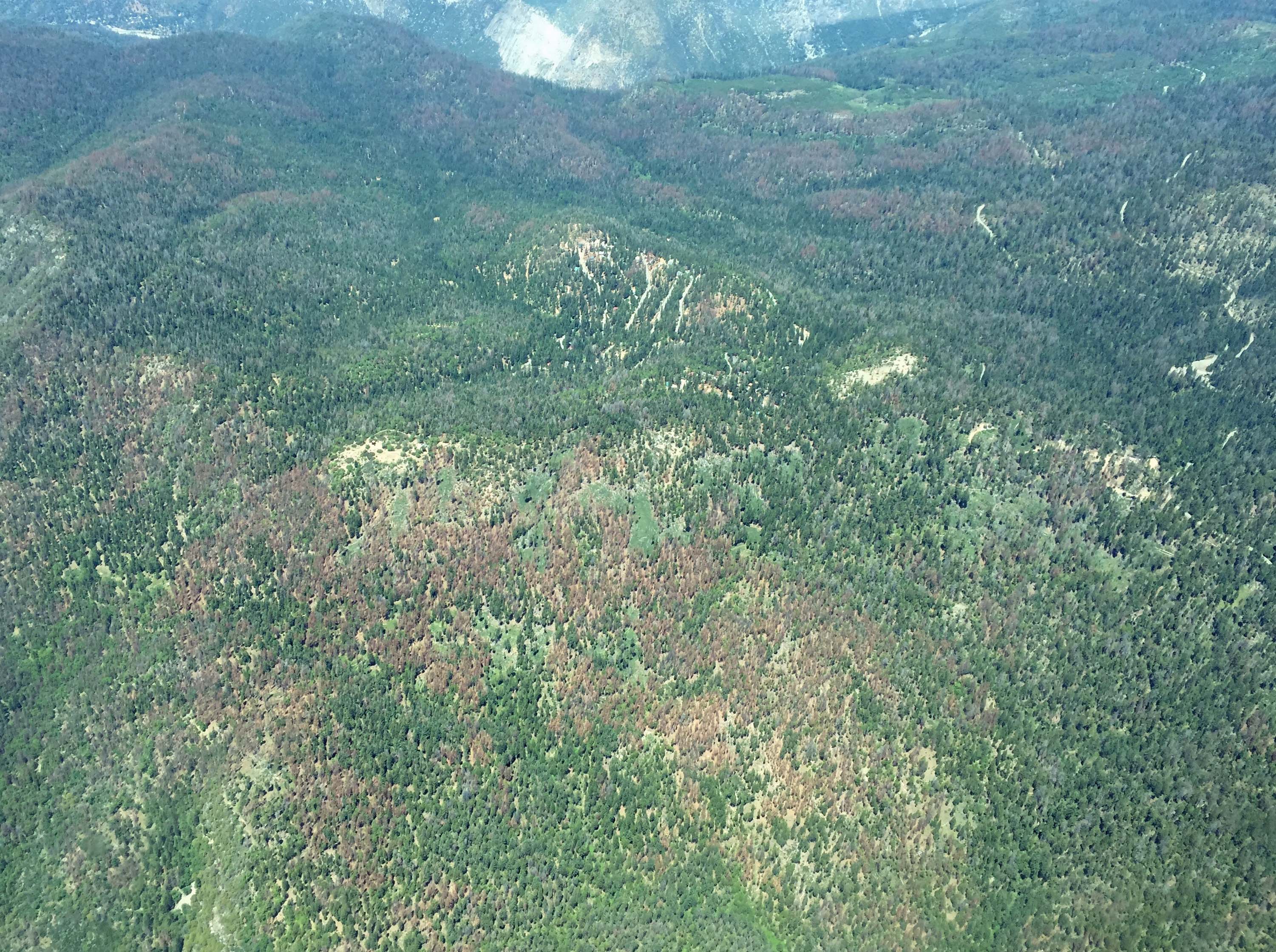
Yosemite West (center right), Henness Ridge and Fire Lookout (center left), Mereced River Canyon(top); view north
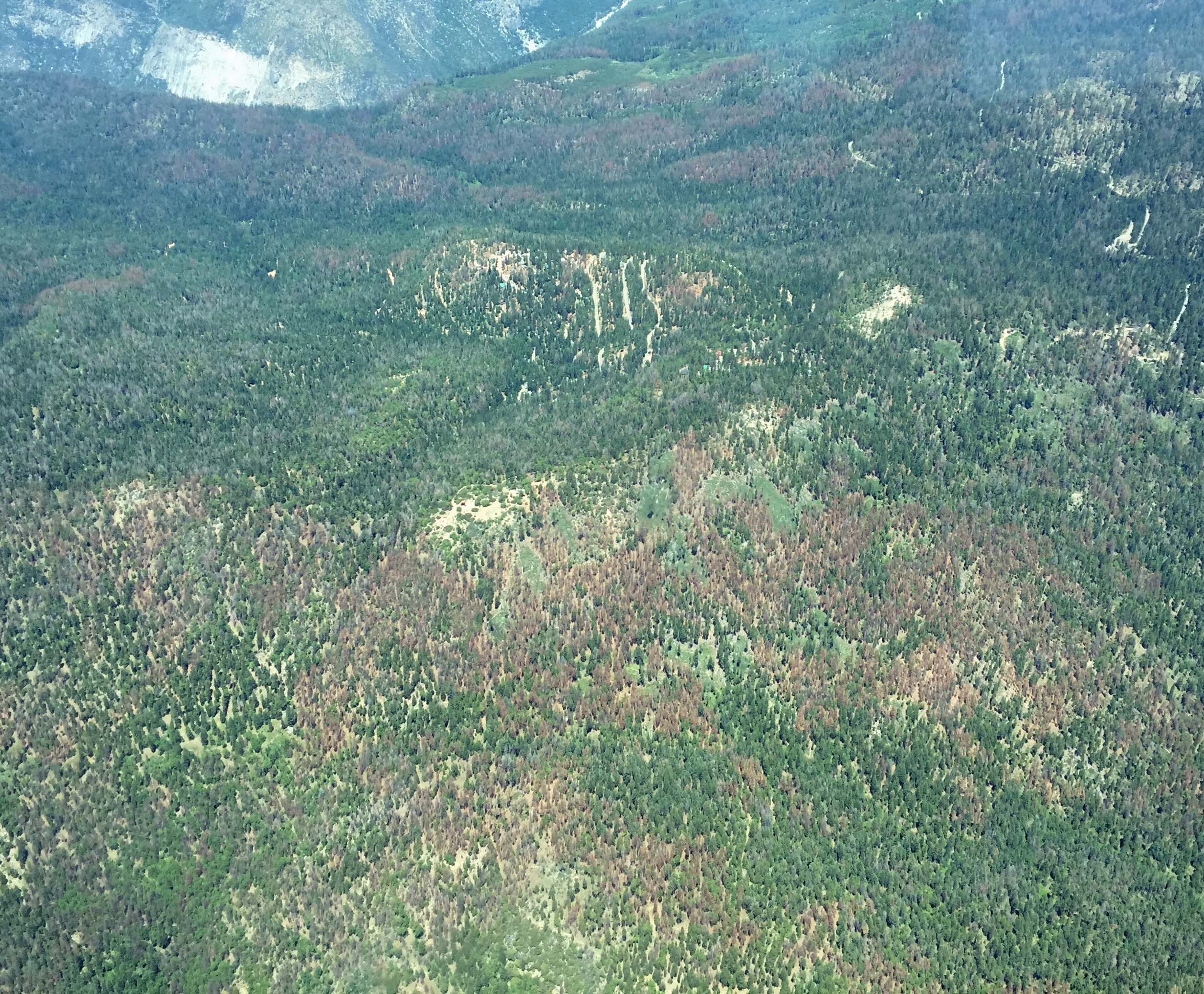
Yosemite West (center right), Henness Ridge and Fire Lookout (center left), Mereced River Canyon(top); view north
Yosemite West (center), Wawona Road (top); view east
Yosemite West and wastewater treatment facility (center), Wawona Road (top left); view south-east
 Copyright text © Yosemite West Property & Homeowners, Inc. 2003-2017. Copyright photographs © John Mock 2004-2017. All rights reserved. Unauthorized redistribution of this document is prohibited. Updated August 31, 2017. |